Before download starts
Please register your contact information below in order to download the file.

Geographical Tools for Military Operations
Teleplan Globe has developed solutions and platforms that meet the requirements of defense organizations globally. We focus on being agile and flexible in terms of adapting to the needs of our customers as well as ensuring interoperability with the environment we meet.
Key in successful military operations is situational awareness and control over geographical assets and insight. Our platform MARIA Geographical Development Kit has been developed for this specific purpose to ensure flexibility, performance and adaptability. We belive that we are unique in this capability. It has proven to be a huge strategic benefit to control this part of a platform rather than depending on 3rd party solutions in the open marketplace.
The Maria GDK is a high performance set of independent client modules and services that enables rapid development of highly tailored GIS applications in combination with your own data and graphics for both 2D and 3D. The GDK enables full integration in client applications without conflict in the user interface. Flexible styling mechanisms enables the host application full control of styling and behavior. Large amounts of information are possible to visualize in groups or simplified views to minimize clutter in the map.
Military operations spanning from surgical special operations to large scale operations and campaigns, intelligence-, targeting-, electronic warfare-, information-, cyber-, and space operations. These different operation types have one thing in common: they are relative to geography. War is an inherently social phenomenon; it involves competition and conflict between humans in all domains. Planners and decision makers require advanced geographical tools for planning, execution, and to generate SA and understanding. The challenge is combining geographical data, presenting it with a single system, with a significant reduction in the need for human analysis. Teleplan Globe offers a solution to meet this challenge.
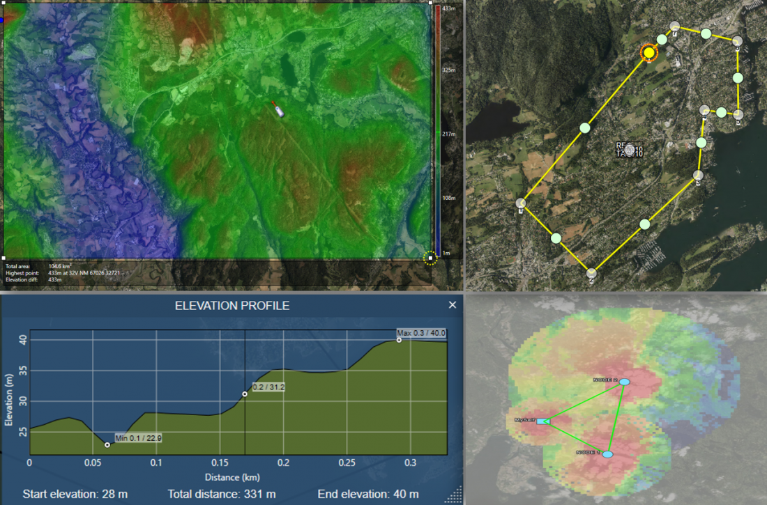
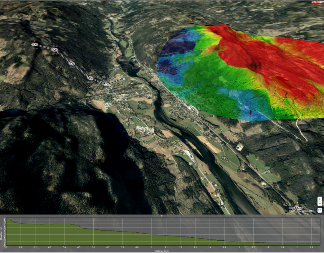
Teleplan Globe’s MARIA GDK (Geo Development Tool) powers the FACNAV map engine. This allows planners to conduct advanced terrain analysis, generate elevation profiles, plan navigation, and calculate time-distance and load, and visualize the work for the planning team, commander, and subordinate units. Additional features include tools for radio propagation and radio coverage calculations, high-performance real-time entity tracking—supports more than 100.000 track updates per second— including aggregation of history and statistics, and rule-based geo-fencing. FACNAV can generate target locations and geographical verification of reported targets with high precision. Teleplan Globe offers an upgrade that combines a high precision optical survey function. This allows the user to combine still and motion imagery from sensors with geographical data, placing and visually presenting targets and objects on the screen with extreme precision, thus satisfying the requirements for a Target Location Error Category 1 (TLE CAT). The FACNAV-map engine’s high-performance tracking and geographical precision eases the burden of the commanders’ decisions concerning risk, collateral damage, and legal issues when it comes to employing kinetic and non-kinetic effects on the battlefield.
MARIA GDK is one of Teleplan Globe’s core products. It supports all our own products and is the map engine for the operational level Norwegian Command Control and Information System (NORCCIS), and NATO’s Tools for Operational Planning (TOPFAS). We strive to be at the forefront of the global development for Geographical Information Systems (GIS). Key to art strategy is to master the art of combination. This allows the user to combine geographical data from all domains; this sets the condition for Situational Awareness and understanding.
Please download our product sheets if you want further information or to engage with our team (Registration Required):

If you would like to know more or engage with our team, please contact us!
Magne Killingstad, Vice President Marketing & Sales
Please register your contact information below in order to download the file.