Before download starts
Please register your contact information below in order to download the file.
Plan and ensure the safety of your VIP’s, personnel and objects with the dynamic geofence capabilities
Your most important task includes keeping either VIP’s, your personnel, or other high-value objects safe. The organisation has operations and people traveling simultaneously in different locations countries- or worldwide. Some of the locations can be characterized as high-risk environments, and you want to make sure that the transportation from the airport to the hotel and other movements goes according to plan.
NORA allows you to track all types of assets in real-time, and alerts can be triggered from the app or another pre-set sensor. What triggers the alert is up to the rules you create.

Geofencing capabilities enable you to have full control during operations and ensure the safety of all your assets.
A geofence is a geographically delimited area that is defined and “fenced”. NORA handles geofencing of any shape made through the dynamic drawing tool. Geofencing is used to monitor or map assets movements. NORA triggers an action when a mobile device or any other type of tracker enters or exits any virtual boundary set up around a geographical location, known as the geofence.
NORA allows both inclusive and exclusive geofenced areas and allows you to set up alerts or alarms when someone enters and/or leaves your predefined area. You can create these geofences based on radius or by drawing the areas directly on the map. The possibilities are unlimited – alerts can also be triggered when two or more people or objects are separated which can be useful when missions include car escorts.
The route planning gives you a tool to plan geofenced routes and react and respond to any deviations during active trips or operations. Routes can be pre-planned or created and changed in real-time for all involved to immediately see the changes in the application. It also gives you the possibility to benefit from the simplicity of importing the map data from external sources. The event log is available for both web and apps – enabling leaders to have control when they themselves are in the field.

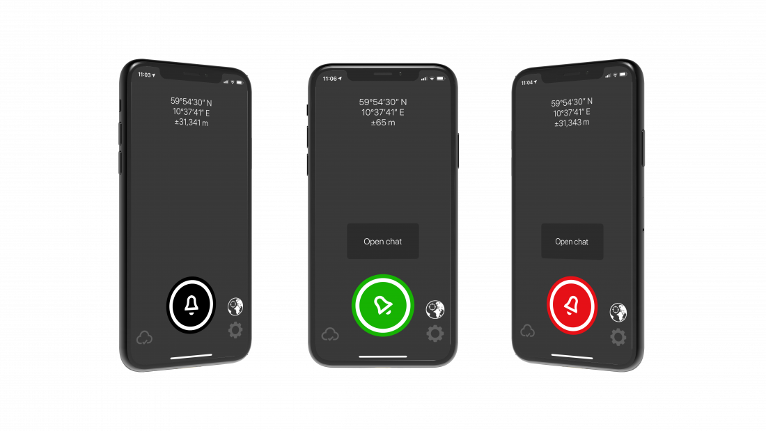
When you have people travelling to high-risk areas, the NORA alarm can be a useful app ensuring their security. Having the app on these peoples phones you can enable real-time tracking while on field missions, or location will first be visual when an alarm is triggered. Within 3 seconds the field personnel can get in contact with the ones in charge, your command centre, GSOC, HR or security team within your organizations or leaders in the field. All communication after an alarm is triggered are silent, ensuring that personnel hiding will not be exposed.
Reports can be generated and sent seconds after an alarm has been pushed. These reports will include information about the alarm sender, the time and location from where the alarm was pushed and other relevant information of your choice. If
NORA Alarm can easily be set up to support any organisations existing infrastructure, and if in place already, be a part of enterprise crisis management systems. With NORA’s interoperability, the alarm can be triggered from external sensors and devices – wearable tracking devices, PPT devices with an alarm button, jewellery, belts and smartwatches to mention some.
NORA Alarm can be a dedicated app for relevant personnel or a part of the full client app NORA so your people have all they need in one view.

Please register your contact information below in order to download the file.